Safety of Prospect Heights Area

Hey guys. I've been reading the PH message board for awhile, and I haven't been able to find an answer to a specific detail.
From what I can gather, everyone seems to (generally) agree that the east boundary of PH is Washington, but I was curious how safe is the area from Washington to Franklin?
I wasn't sure if I should post this on the CH board or here. I know that nothing can replace walking around myself, but I thought I would get your opinions. Any information would be greatly appreciated.
Comments
-
Yeah, find out for yourself. Or search the countless other threads on this subject.
-
Actually I think the border is a little further east than that, at least this map, which is supposedly from the original platting:
http://brooklynpix.com/photoframex1.php?photo=/photo1/C/crhts9801.jpg&key=CRHTS
9801
I live on Eastern parkway between Classon and Frnaklin and I think it's fairly safe. It's not Park Slope or anything, but I just think shit you live in NYC not some small town you gotta deal with some occasional sketch.
I used to feel the same way about alphabet cirty back in the late 80's early 90's and I wish it was still the way it was back then. -
IF you look at this one it looks like the borer between PH/Crown Heights is the shuttle tracks:
http://brooklynpix.com/photoframex1.php?photo=/photo1/P/pheights9801.jpg&key=PHEIGHTS 9801
Not that I'm vouching for the accuracy, just putting it out there. -
I know it sucks, but live in Crown Heights. Why can't you be proud.
-
Did anyone else catch the old photo of the SSOC ATED (or however it was) spot?
http://brooklynpix.com/photoframex1.php?photo=/photo1/P/pheights40.jpg&key=PHEIGHTS 40 -
Lo Kee, I call bullshit on those. The blue lettering for the neighborhoods is clearly not on the original maps, and has been added for the website.
-
Lo Kee wrote: Actually I think the border is a little further east than that, at least this map, which is supposedly from the original platting:
What I see is a map with blue borders and blue/white lettering made by a paint software program. -
pretty sure they were made my Corcoran
-
Carnivore wrote: Lo Kee, I call bullshit on those. The blue lettering for the neighborhoods is clearly not on the original maps, and has been added for the website.
Carnivore I think you (and several others who are adamant on this point) might be mistaken. I can see why you think the map is bullshit but merely because it has been colorized/enhanced for clarity doesn't mean it's false. I have seen quite a few old surveys and platens (I am deeply interested in old NYC history) and it seems that the PH/CH border could seriously be Franklin Ave. This is not just some real estate broker creation. At worst, this is a debatable issue. So at least consider that this map has some veracity to it. Also there is the neighborhood map at the Park Place Shuttle stop which shows the Franklin Ave to Wash Ave area as Prospect Heights. Yeah, yeah, I've read the arguments that this map is made by some MTA hacks who don't know what they are doing or that some realtors have influenced the cartographers. This still doesn't negate that there might be historical fact underlying the map.
PS: Though I may be "new" to this message board, I am not new to NYC or Brooklyn. -
Like I said, not saying its the absolute truth, just putting it out there
-
Well, among other hints, even the expanded Prospect Heights Historic District ends at Washington. The area between Washington and Franklin isn't necessarily any worse, but it simply isn't PH. This issue is only considered debatable by the folks who live there and want their real estate values to be tied to PH, not CH.
-
What difference does it really make what the name of your neighborhood is? If you're happy, then cool. If not, then leave. Plus, if you tell people you live in Crown Heights they'll think you're gangsta which will in turn give you that elusive street cred that we all seek.
-
madman wrote: Well, among other hints, even the expanded Prospect Heights Historic District ends at Washington. The area between Washington and Franklin isn't necessarily any worse, but it simply isn't PH. This issue is only considered debatable by the folks who live there and want their real estate values to be tied to PH, not CH.
So based on this logic then Clinton Hill is only like 4 blocks wide? I don't think so. Historical district designation does not reflect the neighborhood boundaries but only a subset at best, sort of the "best" of what that neighborhood represents architecturally.
I do agree that -- in a way -- it doesn't matter what 'hood you live in so long as you are happy. And if I live in CH so be it. But I think this issue in an academic sense is not as you (and some others) characterize it: me and others striving (perhaps conniving?) to make our little corner of Brklyn. something it is not. There certainly is a different "feel" about the blocks btwn. Washington & Franklin and say Vandy or Underhill. But a lot of that is just gentrification. Hey 20 years ago Prospect Place near Flatbush was a shitpit. I like the folks on my block and I feel welcome here and though there are (I am sure) a few who are bummed about the changes/development, over time, I think it'll all be for the collective better. -
The Encyclopedia of New York City (Yale Univ. Press) lists Washington as the boundary. This was the argument that finally won the battle against the real estate agents who kept trying to change the boundary on Wikipedia.
-
Some chick maced herself in the face in Prospect Heights the other day.
Lock yo doors.
I meant pepper-sprayed herself in the face.
BTW.
-
madman wrote: This issue is only considered debatable by the folks who live there and want their real estate values to be tied to PH, not CH.
...and, of course, the people who live in the nicer parts of PH, who don't want their property values associated with the blocks to the east.
for the record: i live in the contested area. i generally say i live in CH, on the border of PH. i like where i live, and i also like the little flash of fear in the eyes of some people when i say "crown heights" (getting less reliable, though). BUT, to tell the truth, i think where i live has much more in common with PH than with the rest of CH.
also, i think acting like eeeveeel brokers are changing something eternal and sacred is pretty ridiculous, given that all of these areas and boundaries were set by real estate brokers (or equiv.) in the first place. -
daver wrote: Some chick maced herself in the face in Prospect Heights the other day.
Good gravy. I'd be embarrassed for those two, except they're obviously too lacking in self-awareness to be all that embarrassed for themselves. -
sweet tea wrote: [quote=madman]This issue is only considered debatable by the folks who live there and want their real estate values to be tied to PH, not CH.
...and, of course, the people who live in the nicer parts of PH, who don't want their property values associated with the blocks to the east.
Actually, no. I don't consider it debatable.
That said, when I was looking for a place to buy in PH I also looked in the area east of Washington. There were several great properties there. And, while I considered a few of them, I never tried to fool myself that it was anything other than CH.
It shouldn't be considered neighborhood bashing to call a place what it is. -
have to work on my reading comprehension.
what i meant, of course, is that both parties have an interest in the debate. -
daver wrote: Some chick maced herself in the face in Prospect Heights the other day.
The only things that those two need to watch out for in Prospect Heights is themselves.
Maybe we should be on the lookout for those urban menaces. I mean, what if one of them decides to "test" the pepper spray just as one of us is walking by on the sidewalk.
Good grief. -
BKChickie wrote: [quote=daver]Some chick maced herself in the face in Prospect Heights the other day.
The only things that those two need to watch out for in Prospect Heights is themselves.
Maybe we should be on the lookout for those urban menaces. I mean, what if one of them decides to "test" the pepper spray just as one of us is walking by on the sidewalk.
Good grief.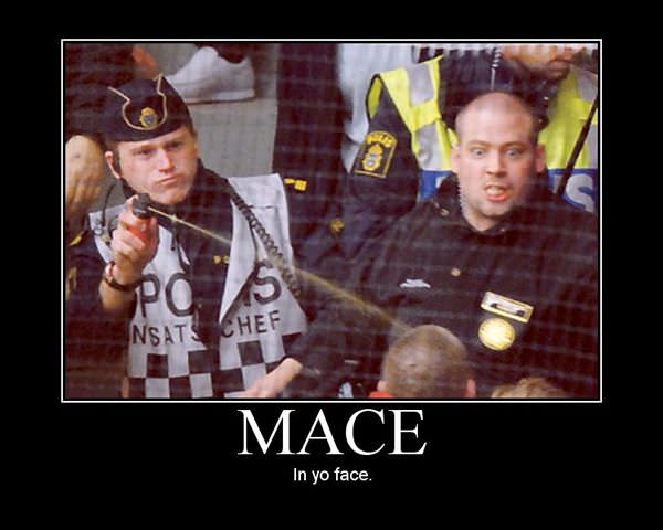
-
sillybilly wrote: [quote=Carnivore]Lo Kee, I call bullshit on those. The blue lettering for the neighborhoods is clearly not on the original maps, and has been added for the website.
Carnivore I think you (and several others who are adamant on this point) might be mistaken. I can see why you think the map is bullshit but merely because it has been colorized/enhanced for clarity doesn't mean it's false.
Just to be clear here, the map is clearly old and not bullshit. What was added recently were the neighborhood borders and labels. Which is printed clearly at the bottom of the map: "Base map courtesy U.S. Geological Survey. Neighborhood map created for and licensed to BrooklynPix by software-arts.com ©"sillybilly wrote: I have seen quite a few old surveys and platens (I am deeply interested in old NYC history) and it seems that the PH/CH border could seriously be Franklin Ave. This is not just some real estate broker creation. At worst, this is a debatable issue. So at least consider that this map has some veracity to it. Also there is the neighborhood map at the Park Place Shuttle stop which shows the Franklin Ave to Wash Ave area as Prospect Heights. Yeah, yeah, I've read the arguments that this map is made by some MTA hacks who don't know what they are doing or that some realtors have influenced the cartographers. This still doesn't negate that there might be historical fact underlying the map.
Where can I look up these surveys and platens, I'm a bit curious too. Online I've looked at a lot of old stuff at the Library of Congress and Brooklyn Historical Society, but I haven't found the sort of neighborhood designations in old maps like you mention. Sometimes Flatbush is labeled, and that is about the extent I have found. Which by the way, generally covers PLG FWIW. Perhaps it is time for a Real Life field trip!
PS: Though I may be "new" to this message board, I am not new to NYC or Brooklyn.
-
in the old map with new labels, part of what is called CH now is marked in old, large letters (not the new label), "Eastern Parkway".
it's not the street name -- it's larger than the street names and several blocks from e pkwy. -
sweet tea wrote: in the old map with new labels, part of what is called CH now is marked in old, large letters (not the new label), "Eastern Parkway".
You're right. Right below Brower Park there. Very interesting...
it's not the street name -- it's larger than the street names and several blocks from e pkwy. -
daver wrote: Sometimes Flatbush is labeled, and that is about the extent I have found. Which by the way, generally covers PLG FWIW. Perhaps it is time for a Real Life field trip!
Yep!
PLG makes up the NW corner of the hyuuuuuge swath of neighborhoods under the overall umbrella of Flatbush.
And speaking of Flatbush being labeled...
There is actually a brass strip and explanatory marker stone right by the Brooklyn Botanical Gardens southern entrance at Empire Ave that shows where the old city of Brooklyn ends and the old village of Flatbush begins.

-
madman wrote: Actually, no. I don't consider it debatable.
Well, I hate to disagree, but I think it is debatable. As someone else here noted, these neighborhood designations were all creations of the real estate brokers or original developers. Moreover, many of the names we associate with mere neighborhoods were really much greater than that. For example, the Original Dutch/English town/city names from Kings Co. -- Bushwick, Brooklyn, Flatlands, Flatbush, New Utrecht and Gravesend (see http://www.bklyn-genealogy-info.com/Town/Bushwick/index.html).
. . .
It shouldn't be considered neighborhood bashing to call a place what it is.
I don't have Kenneth Jackson's Encyclopedia of New York (though I recognize that he is a terrific historian/scholar). The book's section on PH/CH obviously must cite to some source material to make the positive statement that Washington is the border. What I would like to know is what is that historical basis? If someone has the book, it would be interesting to know what Prof. Jackson cites as authority.
Next time I get to a bookstore I'll look it up too.
And FWIW, I don't want you to think I am accusing you or anyone of neighborhood bashing at all. I am merely just interested in getting to the bottom of this historical issue and I am not convinced by any of the "evidence" presented thus far. [Kind of like having a discussion over some beers at a pub.] -
My favorite is the original name of Cobble Hill (before the Dutch renamed it to something resembing its present name):
Ponkiesburg.")
-
sillybilly wrote:
Have fun debating yourself.. and anyone you try to sell CH real estate to. I'm out of this thread.
Well, I hate to disagree, but I think it is debatable.")
-
Ok ... well now that Madman is out here is what I found out this evening.
I went to the bookstore and took a look at the Encyclopedia of NYC. First off, this very large volume is comprehensive to be sure. Ken Jackson didn't write this book but was the editor for all the of entries. The "Prospect Heights" entry (p.945) was written by Judith Berck (a freelance writer, not a historian). Ms. Berck notes that the boundaries of PH are Flatbush, Atlantic, Eastern Parkway and Washington. What is interesting is that there are NO citations to any sources for this or anything in the entry.
When I looked up the entry for "Crown Heights" (f.k.a. Crow Hill) (p.301) by Ellen Marie Snyder-Grenier (fmr. Chief Curator of the Brooklyn Historical Soc'y) the key boundaries are noted as Park Place (!) to the North and Franklin to the East. What's interesting here is that the few blocks I am trying to identify (the area bounded by Atlantic, Eastern Parkway, Washington and Franklin) is left out of the definitions of both neighborhoods. (No citations either in this entry.)
What I am beginning to think is perhaps PH included the area up to Classon and that beyond Classon belongs to CH.
In any event, I know that the Brooklyn Museum has a collection of old maps of this area so I am going to check these out. In any event, the plot thickens as far as I am concerned. Without any historical sources being cited for support, the Ency. of NYC is not the definitive answer on this issue. Back to the historical records! -
sillybilly wrote: Back to the historical records!
Ah yes, the historical documents!


Howdy, Stranger!
Categories
- 40K All Categories
- 27.1K Neighborhoods
- 5.1K Crown Heights/Prospect Lefferts Gardens
- 7.1K Prospect Heights
- 2.3K Fort Greene, Clinton Hill, Bed-Stuy
- 8K Park Slope
- 549 Williamsburg, Greenpoint, Bushwick
- 442 Flatbush/Midwood/Ditmas Park
- 657 BoCoCa (Boerum Hill, Cobble Hill, Carroll Gardens)
- 151 Red Hook
- 104 Gowanus
- 304 Bay Ridge/Bensonhurst
- 130 Coney Island, Brighton Beach, Sheepshead Bay
- 270 Brooklyn Heights, DUMBO and Downtown
- 598 Windsor Terrace / Kensington
- 673 Greenwood Heights and Sunset Park
- 749 Brooklyn and Beyond
- 6.3K Stuff
- 86 Brooklyn Back When
- 1.2K Brooklyn Pets
- 257 Brooklyn Kids
- 241 Brooklyn Eats
- 51 Brooklyn Booze
- 3.6K The Lounge / Random Stuff
- 611 Brooklyn Politics
- 122 Brooklyn Sports and Fitness
- 111 Brooklyn Photos
- 339 Site Issues
- 8 Frequently Asked Questions (FAQ)
- 6.2K Listings
- 1.1K APARTMENTS and REAL ESTATE
- 1.3K Sales Openings Events
- 2.3K The Classifieds